Kayaking. Los Angeles River. I know, these two things don’t seem to go together, especially when every Angeleno’s impression of our namesake river is a garbage-strewn flood channel full of dead bodies.
But I’m going to fill you in on a secret: It’s clean. It’s fresh. And dare I say it… You might even forget you’re paddling the Los Angeles River once you’re on it.
The 51-mile Los Angeles River was closed to the public in the 1930s, when major flooding prompted city officials to pave its banks with concrete to improve storm drainage. Since then, the river has been a designated flood control channel under management by the Army Corps of Engineers. It was not until 2010 that the Environmental Protection Agency declared the river a “traditional navigable water,” which allowed for Clean Water Act protections.
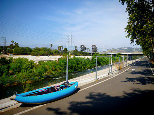
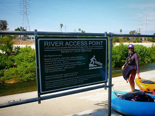
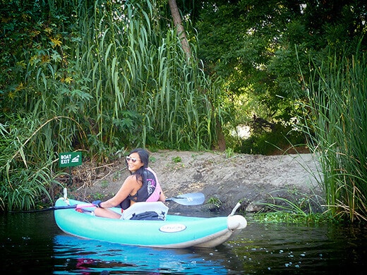
As a result, the LA Conservation Corps led a pilot program in the summer of 2011 that opened a 1.5-mile section of river to the public. That section, the Sepulveda Basin Recreation Area in San Fernando Valley, offered guided kayak trips down the sycamore and willow-lined banks of the river. But with limited public access, the trips often sold out within hours of opening reservations (even this summer!), so many people never get the chance to paddle that elusive segment of river.
This year, a new program managed by Mountains Recreation & Conservation Authority opened a 2.5-mile sandy-bottomed stretch of river along Glendale Narrows in Elysian Valley. The Pilot Recreation Zone opened over Memorial Day and will run through Labor Day, when river conditions are calmest. Even then, expect to find a few surprising Class I and II rapids on this run!
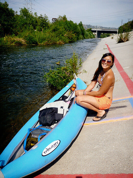
There are a few outfitters with rentals that will guide you down this section, but anyone with a steerable, non-motorized watercraft (kayak, canoe, or paddleboard — though it’s much too shallow and rocky for a canoe or paddleboard in my opinion) can use the river without any permits or fees. The program site offers a downloadable trail map detailing every rapid and hazard on the run. It’s a good idea to bring it with you because even with our keen river knowledge, we managed to make a wrong turn and had to portage our kayaks through heavy brush (very interesting experience, to say the least!).
So, things I learned after being on the river: Bring a map (or use a guide), wear sturdy river shoes, and wear a helmet if you’re paddling a hard shell river kayak. The rocks underneath can flip you if you’re not paying attention, so it would be pretty easy to hit your head if you’re in a closed kayak.
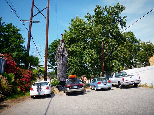
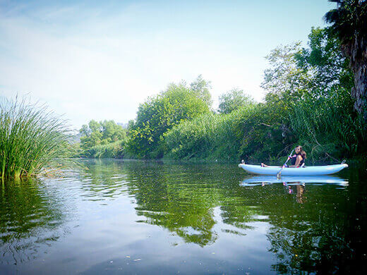
We put in at the river access point near Rattlesnake Park in Glendale. It’s a little sneaky to find — just a dead-end side street with an opening in the fence that leads you onto the Elysian Valley bike path.
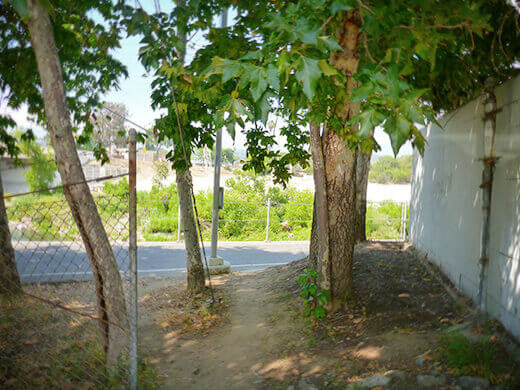
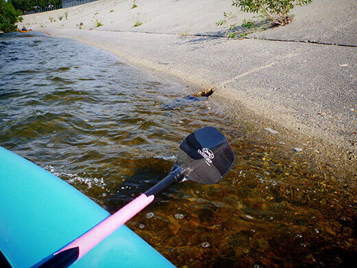
The put-in is just south of the Fletcher Avenue bridge, and you have to drag your boat down the steep concrete embankment to get to the river. Eventually, I hope they’ll build a better launching pad to be more welcoming to beginners… perhaps a sandy beach or a man-made eddy?
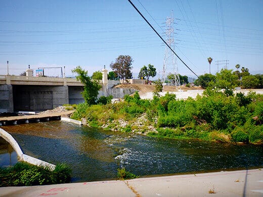
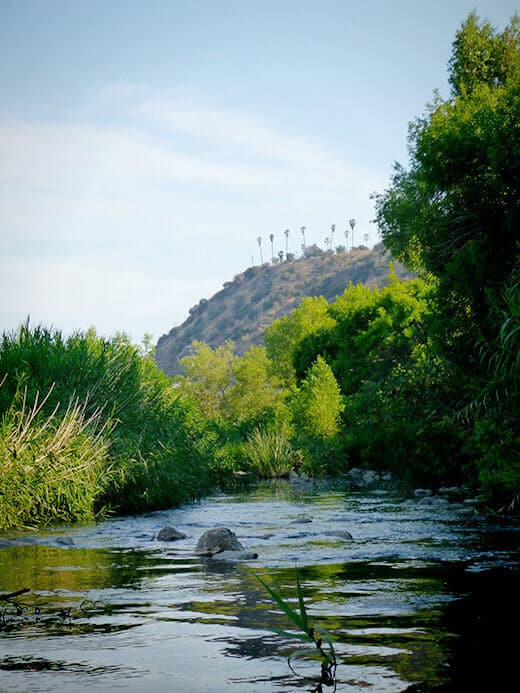
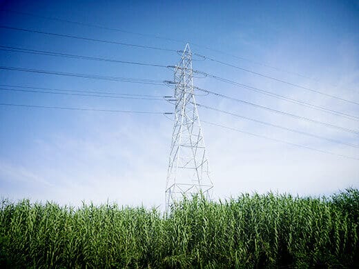
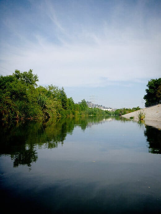
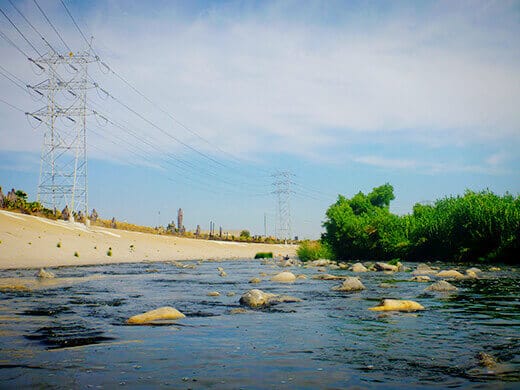
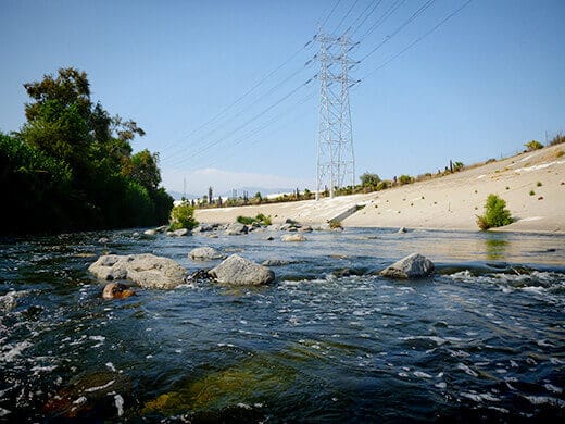
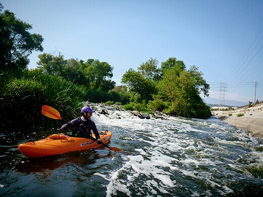
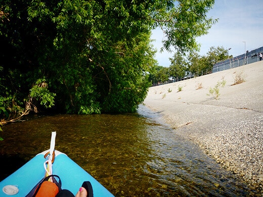
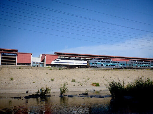
Right off the bat, we paddled through the Class I Rattlesnake Rapids! But then we floated down a fairly calm section of river where anglers sat patiently on the concrete side waiting for their catch, and lush vegetation (with the occasional utility tower) covered the other side.
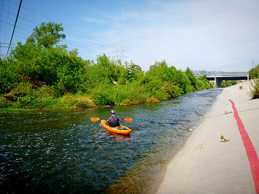
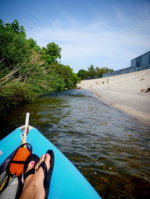
The river was probably deepest at this point — knee-high? — and glassy as a lake. If it weren’t for the cement bank, you’d never realize you were in an urban environment. All you could hear were the sounds of birds and the rustling of leaves… it was surprisingly peaceful and beautiful.
And do you recognize this tree?
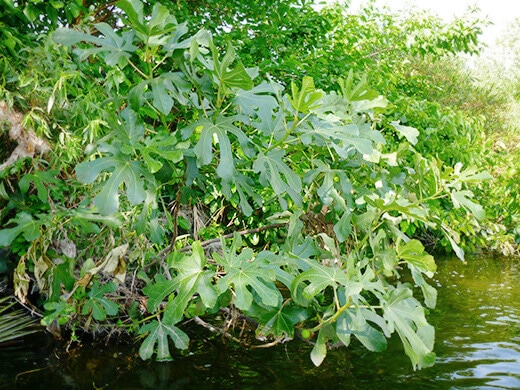
A wild fig! With baby figs starting to sprout!
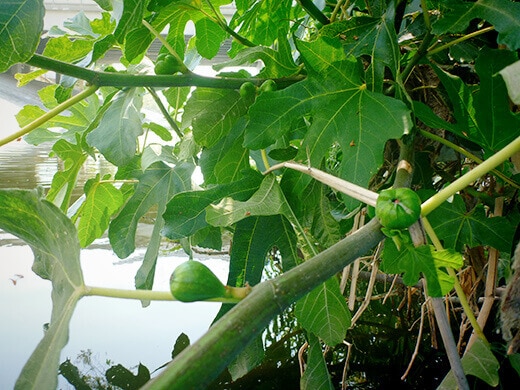
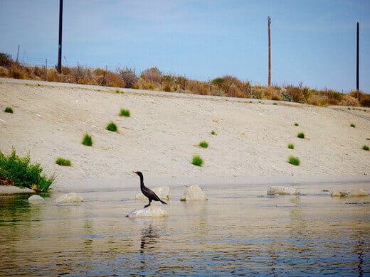
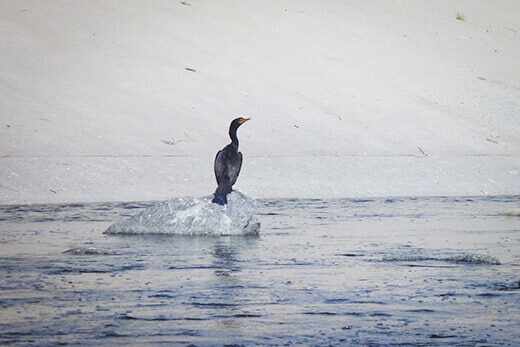
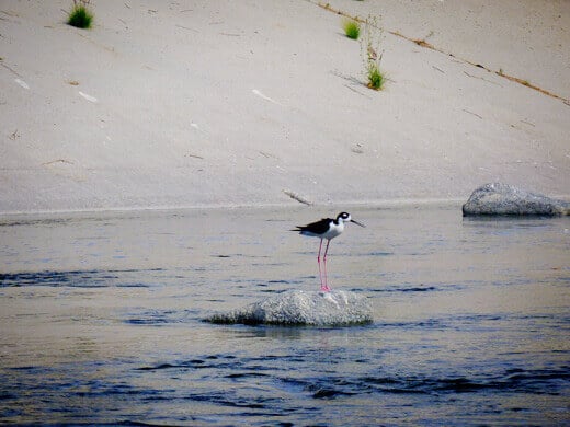
We saw lots of wild figs on this stretch, along with snowy egrets (what seem to be the official bird of the LA River), American coots, blue heron, and black-necked stilts.
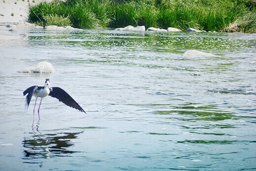
Ah, the black-necked stilt. I loved its flamingo-like legs.
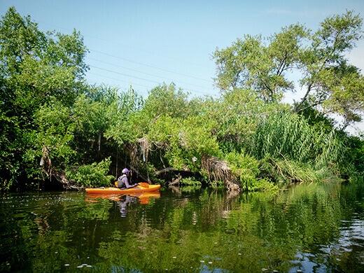
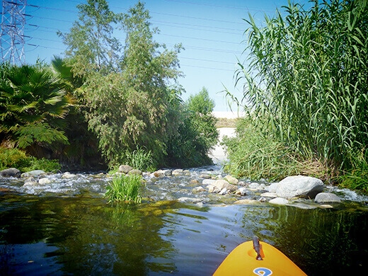
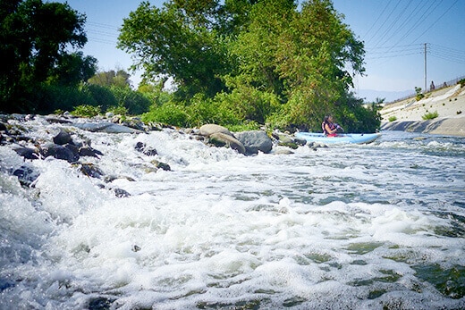
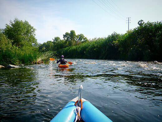
Many parts of the river involved some tricky maneuvering through boulder gardens where the water was only 6 inches deep. The shallow chutes made for some fun little drops in our kayaks!
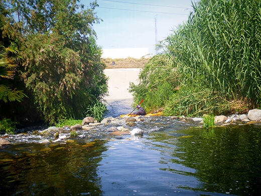
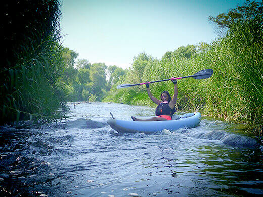
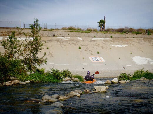
And then there was this awesome Class II chute at Marker 6 (Benedict Rapid)… Not too gnarly, but there’s only one way to go down and you do have to align yourself perfectly, as rocks on either side are just threatening to toss you!
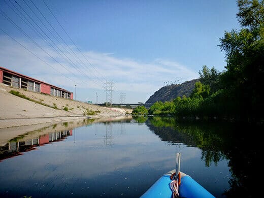
Between Markers 5 and 4, we passed Rio de Los Angeles State Park. The hubs and I have been volunteering on that project for the past year, which opened in 2007 as part of the river restoration process. Eventually, the restoration will extend into the empty lot between the river and the park — a no man’s land called Taylor Yard that used to be a Union Pacific rail yard — and connect park visitors to the actual Rio de Los Angeles (Los Angeles River, that is).
That means one day, instead of seeing a sterile cement bank, we could actually see beautiful terraced parkland along the river. It’s an ambitious plan that may not come to fruition for many more years, but it has to start somewhere. (If you’d like to be a part of the process, read more about it here, then consider donating your time or money to the California State Parks Foundation, Friends of the Los Angeles River, or the LA River Revitalization Corporation.)
At one point the river narrowed significantly — maybe 6 feet across — but the water was so swift that my boat was just skimming the surface of the cement, inches above it, before I hit a major strainer.
Pretty sure we were on the wrong side of the channel… I mean, who puts a tree in the middle of the river?! (If this program takes off, I would happily volunteer to do some bushwhacking for the sanity of future kayakers! And in return, I would ask for just a teensy bit more water in the channel to navigate more smoothly… Army Corps of Engineers, are you reading this?)
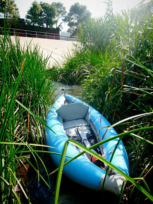
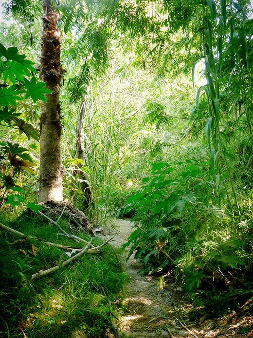
Then there was that other wrong turn… or maybe it was the right turn, but we didn’t realize it involved a portage. This is what it looks like when you have to haul a kayak through head-high vegetation to the other side of the channel.
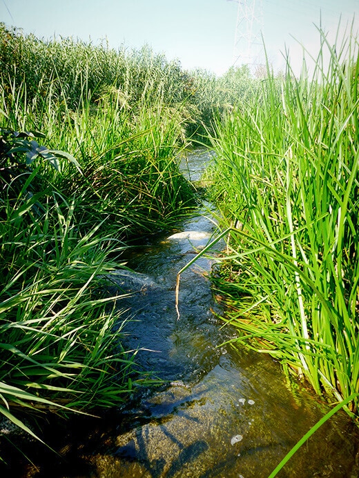
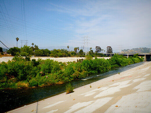
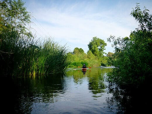
I’m not complaining though, when most of the river looked like this…
And this…
Over the entire 2.5-mile stretch, we saw not a single other paddler on the water. On a Saturday. On a hot, sunny, beautiful Saturday. Who knows how long the solitude will last, but we’ll enjoy it while we can!
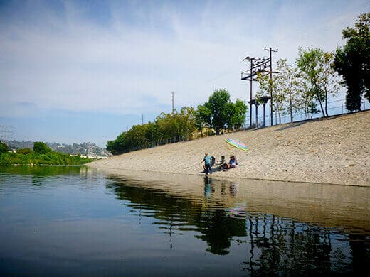
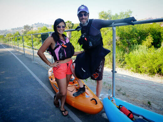
At the end of our run just north of the freeway overpass, we reached the take-out point at Egret Park, a lush little oasis that was built during the revitalization phase.
I never thought I’d see the day when we could actually kayak the LA River, and just a week after it officially opened. We kind of felt like pioneers! And I was so stoked when a jogger on the path stopped and asked about my experience on the river, as he’d been intrigued about paddling it himself. For anyone else that may be intrigued, I say: Go for it!
We want more people on the river to show the city that we need this! More people means more publicity, and more publicity means more planning and funding to revitalize what should be a beautiful emblem of LA (and not just a location for another action-flick car chase). Though we still have a long way before the rest of the river opens for recreation, this is such a huge and positive step in the right direction.
When I told my friends I’d kayaked the LA River, all the usual questions popped up: Did I step on any crack needles? Run into homeless people? Swallow any water?
No, no, and no. The Glendale Narrows segment is a gem. Half of it felt like a natural river with rapids and wetland wildlife, and the other half felt like an urban waterway with cyclists and pedestrians on the bike path above the river. Several times, curious passersby would stop on the path to watch us paddle downstream.
It seemed like the conservation group did a great amount of clean-up on the river, and aside from a few plastic bags trapped in trees (just another reason to push for a bag ban in LA County), there was hardly any trash in the water or along the bank.
We didn’t see any vagrants or shopping carts, and there were no encampments like what you might find in the more industrialized parts of the river further south.
The water was very clean, and probably cleaner than most of the beaches in LA. It’s also pleasantly warm, which is in stark contrast to other rivers like the Kern that are fed by snowmelt.
Get the details here. Go there this weekend. Have a blast and marvel that this is right in our backyard… in the middle of a city!