
I’m not good with numbers. But this is what I do know…
I’ve been home for a little over 2 weeks.
I just downloaded 2 memory cards containing 2,655 pictures.
I just transferred 114 pictures from my phone to my computer.
I managed to tick off 37 states in 48 days on The CSA Cookbook Road Trip.
That’s 76 percent of the continental US, seen from at least 80 percent back roads, farm roads, ferry routes, state scenic byways, National Scenic Byways, All-American Roads, and National Parkways.
That’s quite a feat considering the speed limit on most of these smaller roads is no more than 45 mph.
It was slow. And wonderful. And if you’re going to complete a loop around the country, it’s the best way to experience the incredible diversity of landscapes and cultures in the grand old US of A.
From the Natchez Trace Parkway in Mississippi to the Amish Buggy Byway in Minnesota, Will and I discovered more about this country than we ever thought we would, simply by veering off major interstates when we had the opportunity.
Taking the scenic route (sometimes by accident… and also known as getting lost, in a good way) also allowed us to document every single stateline crossing, rain or shine, upon entry or upon exit.
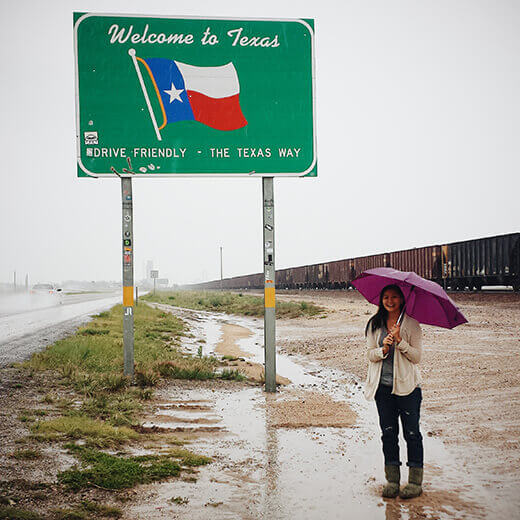
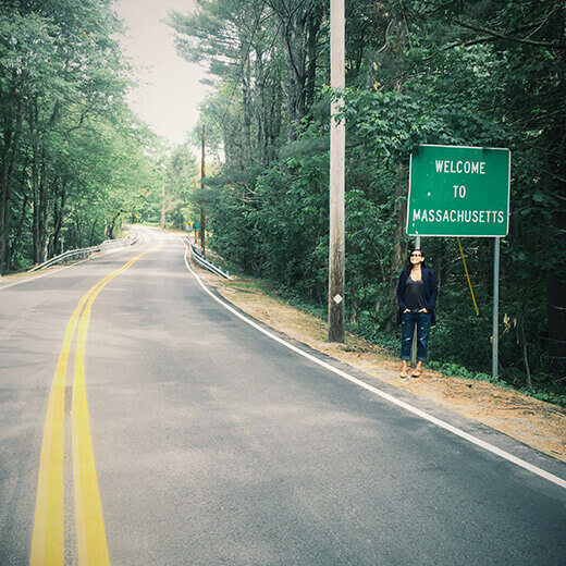
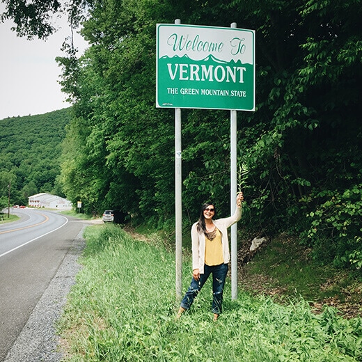
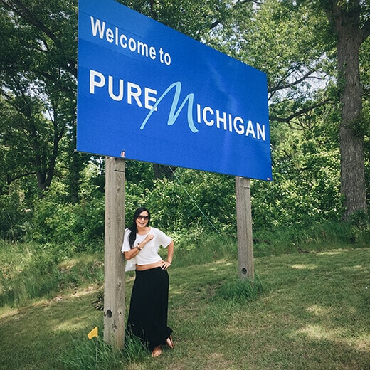
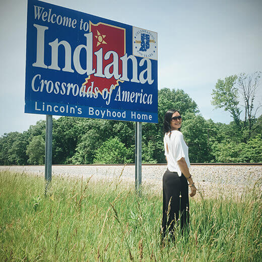
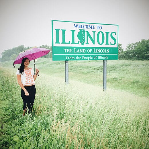
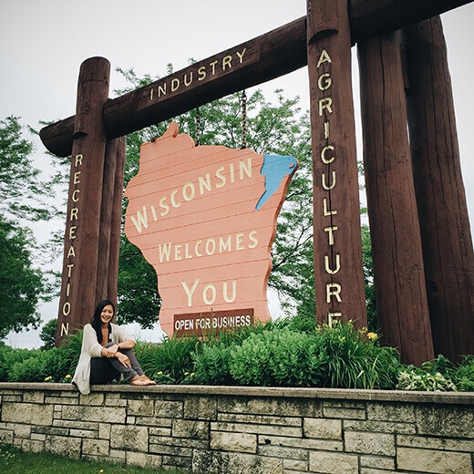
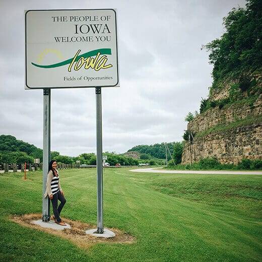
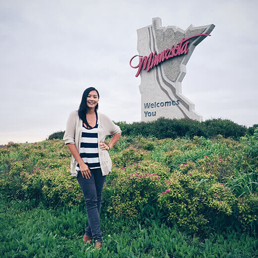
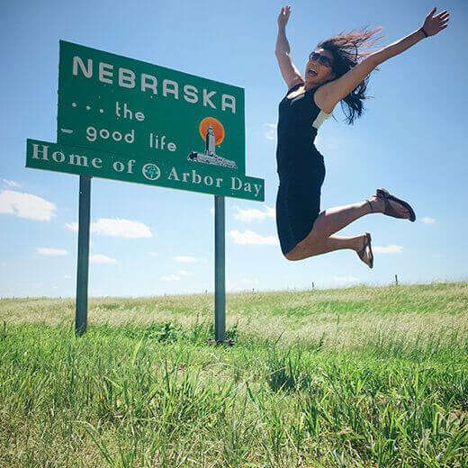
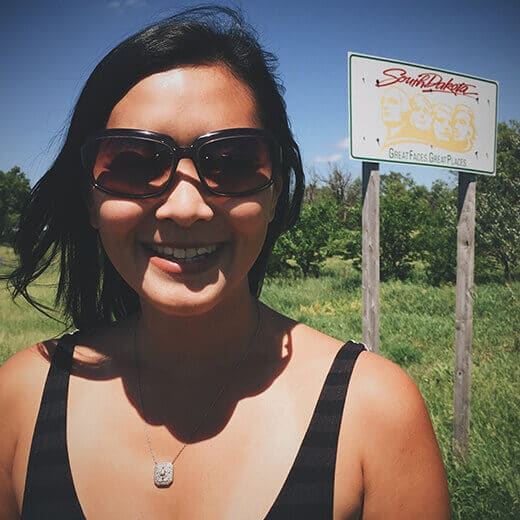
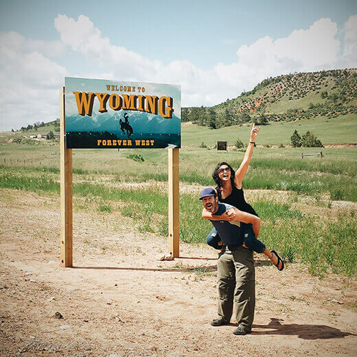
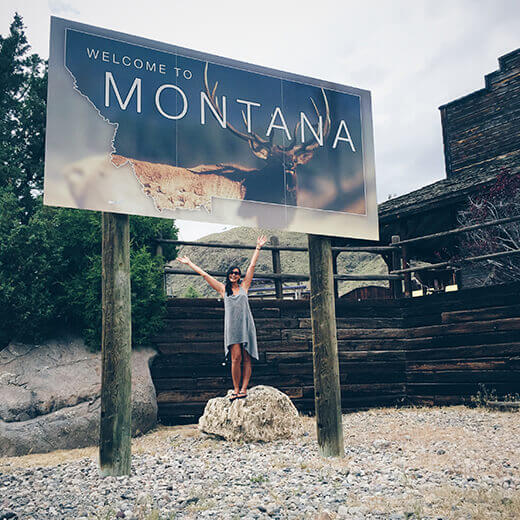
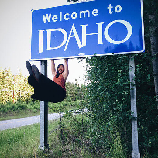
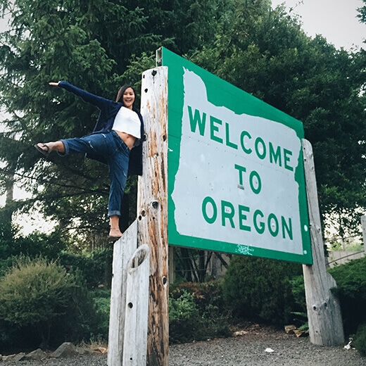
We found welcome signs at visitors’ centers. In the middle of medians. On the sides of highways. Big or small, we managed to find signs in places where we could safely pull over in all 37 states.
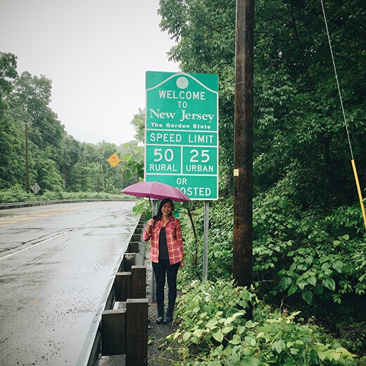
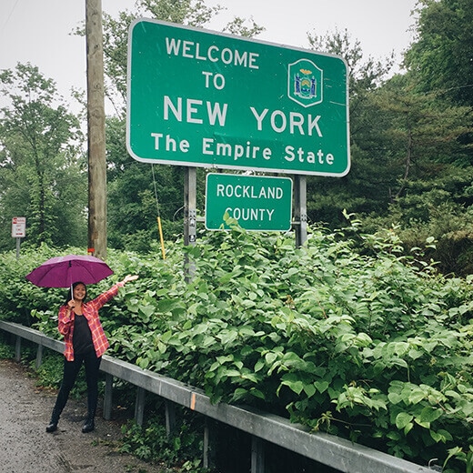
The trickiest sign to find was New Jersey, which seemed to be surrounded on all sides by major waterways. We crossed countless bridges and even took the turnpike, all to no avail.
We finally took the “scenic route” on Route 9W along the Hudson River and found a small “Welcome to New Jersey” sign near the Lamont-Doherty Earth Observatory.
We parked (probably illegally) in the dirt off Ludlow Lane. The security guard was whistling at us as we ran across the street in pouring rain and snapped a picture of not only New Jersey’s sign, but New York’s as well. Before he could approach our car, we peeled out, giggling like teenagers.
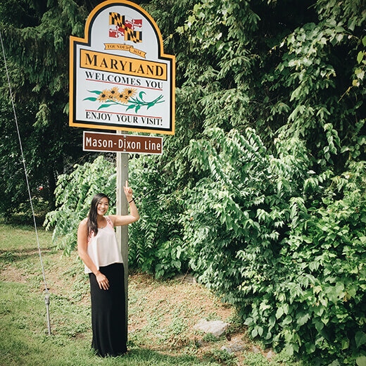
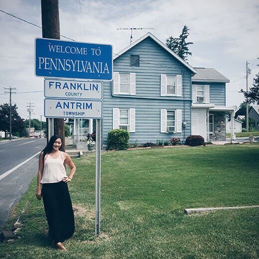
This double-teaming of signs happened at a few borders, actually, like Maryland/Pennsylvania and Oregon/California.
It was especially fun to drive through all the tiny states along the eastern seaboard and breezily check off 5 states in a day!
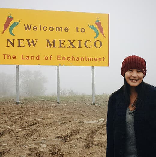
The coldest stateline crossing was Colorado into New Mexico. It was 40°F in late May, foggy and drizzly, and we drove through the stormiest spring the region had seen in 20 years.
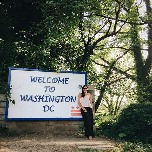
The hottest (or should I say stickiest) stateline crossing was across the country in Washington, DC, just 10 days later.
The 90°F heat wave and 1,000 percent humidity were so intense, I think I lost 10 pounds in sweat while bikesharing in DC (which was all for the better, since I’d gained as much during our “biscuit tour” through the south!).
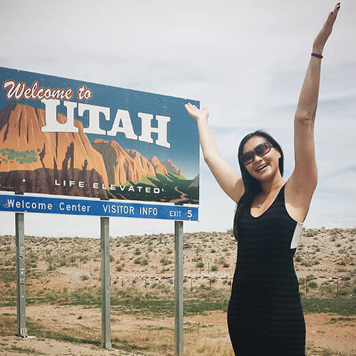
Of all the signs we stopped at, I loved the messages on Utah and Nebraska the most.
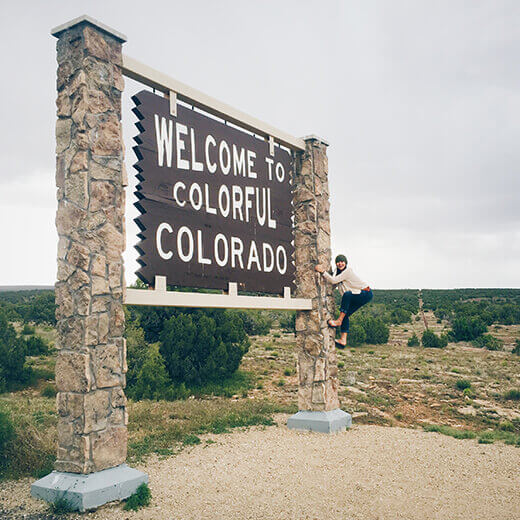
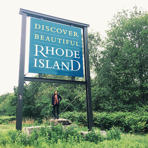
I thought Rhode Island really knew how to wow its visitors with a sign we couldn’t miss, and Colorado could have been a little more colorful (I’m not talking about the weather).
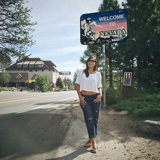
I expected Nevada to be flashier (after all, we were crossing into Reno) and Wisconsin’s rustic wooden sign was beautiful and befitting.
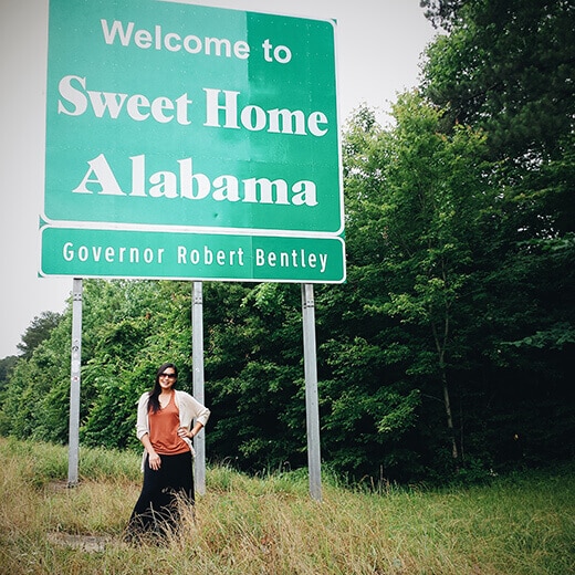
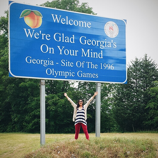
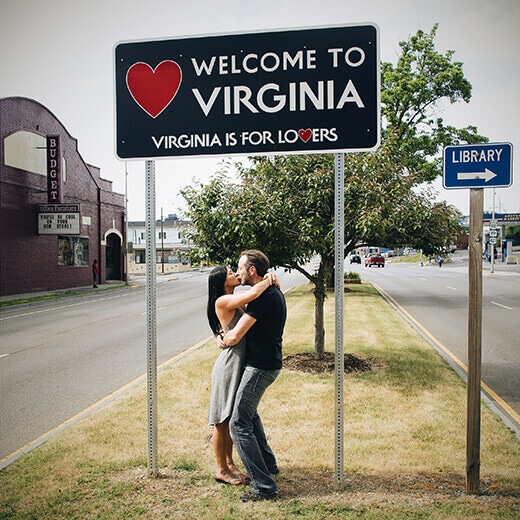
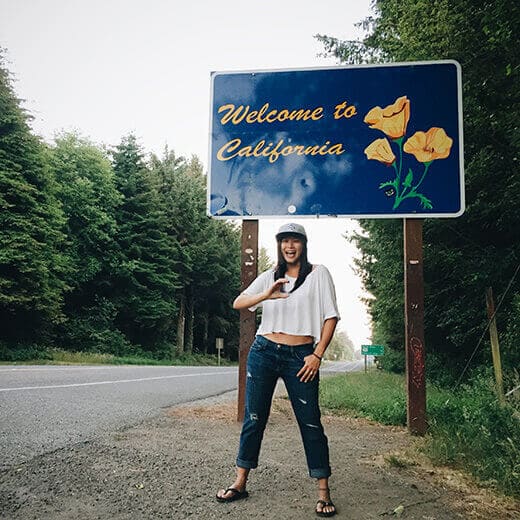
I couldn’t get Alabama and Georgia out of my head, but hands down, my absolute favorite sign of all 37 signs was Virginia (and you’ll see why).
We missed the Nevada sign at the start of our trip, since we drove in to Las Vegas at night, but found another one in Lake Tahoe as we started making our way home on Day 47.
It felt auspicious to begin and end the book tour at both borders of my original home state, Nevada, and my home state for the last 13 years, California.
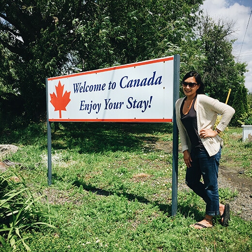
And though I say 37 states, technically it’s 35 US states, 1 US federal district, and 1 Canadian province. Our detour through Ontario (to visit Niagara Falls) still counts as a state, right? I’m going with it.
Here they are in order of appearance, starting with Nevada and circling counterclockwise to California. Thanks, America, for a once-in-a-lifetime trip. (And to Kia for sponsoring my book tour!)
For round two (some day… and hopefully it will involve an RV), I think we need to zigzag through all the middle states and then up to Maine!
Which one is your favorite? Or, give a shout-out to your home state!


#TheCSACookbook #RoadTrip began and ended in Nevada and California. Life in the Slow Lane: 37 States in 48 Days http://t.co/nlN3Q6rXtq
I drove 11,000 miles on my book tour. Find out where I went: Life in the Slow Lane: 37 States in 48 Days http://t.co/TttgecUC43 #travel
Scott C. Poole liked this on Facebook.
Which state sign is your favorite? Life in the Slow Lane: 37 States in 48 Days http://t.co/7mVRTh4yQx #thecsacookbook #roadtrip #booktour
Rain or shine, we found a sign at every state crossing! Life in the Slow Lane: 37 States in 48 Days http://t.co/49F2UsWIL2 #roadtrip